A470(T) Blaenau Ffestiniog to Cancoed Improvement |
 |
Whole Project Award
Project Team:
Client: Transport
& Strategic Regeneration, Welsh Assembly Government
Design: Gwynedd
Consultancy and White
Young Green
Construction: Carillion
Contractor’s Designers: Gifford & Richards
Moorehead & Laing
 |
|
The project
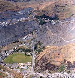
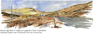
The upgrading of this 4 km (2 ½ miles) stretch of the A470 Trunk Road from Blaenau Ffestiniog northwards to Cancoed was finished in September 2008 and completes a programme of improvements between Blaenau Ffestiniog and Betws-y-Coed. The road passes through a valley with steep sides formed by slate waste tips, climbs northwards to the Crimea Pass and crosses open moorland as it drops down into the Lledr Valley within the Snowdonia National Park.
The objectives of the scheme were to improve road safety and journey-time reliability by upgrading the road whilst also minimising its impact on this environmentally sensitive area and taking advantage of opportunities to enhance the environment.
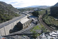
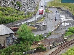
Difficulties in constructing the new road between slate waste tips and five listed structures in the Llechwedd exchange sidings area at Pont Pant-yr-Afon were overcome by constructing a temporary diversion route through the exchange sidings area and carefully planning traffic management to minimise delays to travellers and ensure safety.
The temporary diversion was constructed on top of a separation layer placed over the existing ground surface and on temporary deck structures spanning over the existing bridges to avoid intrusive excavation into archaeological remains and preserve the historical value of the Llechwedd exchange sidings.
 |
|
Collaborative approach
Crucial to the success of the project was its careful design and programming, innovation in construction, diligent application of Environmental and Quality Management Systems, and the establishment of good relationships between the project partners, the local community and statutory bodies. This approach enabled the construction team to remain on programme, despite working within some of the most challenging terrain to be found anywhere in the region.
An Environmental Liaison group was established prior to work commencing and was maintained throughout the project. It consisted of representatives from the Countryside Council for Wales, Cadw, the Environment Agency, Snowdonia National Park Authority, Gwynedd Council and the principal project partners. The group met on a regular basis to discuss appropriate mitigation measures and assess their effectiveness.
 |
|
Waste minimisation
Minimising waste during construction was a key objective and extensive use was made of slate waste, which was graded to produce materials suitable for general fill through to pipe bedding and sub-base.
This meant that no new materials were required to construct the road up to the underside of the surface tarmac. Amongst other factors, CO2 production and the volume of waste taken to landfill were closely monitored and the site achieved significant reductions compared to similar sites.
 |
|
Drainage
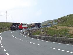
The existing road drainage was uncontrolled, running into roadside ditches and through ‘scuppers’ in the existing walls to adjacent fields. The new highway drainage consists of gullies, filter drains, carrier drains and combined filter and carrier drains. Surface water is discharged from the highway drainage system into existing watercourses.
Existing watercourses crossing the route have been taken through large culverts to ensure that even the most intense storm flows are conveyed safely beneath the road. Salvaged and new stone was used to line the stream channels and for the masonry facing of the headwalls, to replicate the appearance of existing headwalls and watercourses found in the area.
 |
|
Ecology and nature conservation
Ecological constraints were identified during scheme development and construction, including evidence of otters and reptiles. The completed scheme incorporates features to assist and protect these species, such as:
- gaps in walls to provide nesting and roosting opportunities for reptiles, birds and bats
- dry culverts and ledges to enable otters to pass safely beneath the road
- otter-proof fencing associated with watercourses that pass beneath the road.
Site clearance and the demolition of walls and a stone barn took place only after extensive surveys of the areas for nesting birds, bats or hibernating reptiles.
 |
|
Landscape
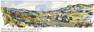
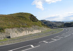
Careful consideration was given to the effects of the scheme on the local landscape. North of the Crimea Pass summit, the high scenic quality of the landscape is acknowledged by its location within the Snowdonia National Park. South of the Crimea Pass summit the trunk road passes through an area included in the Register of Landscapes, Parks and Gardens of Outstanding Historic Interest in Wales.
Account was taken of the grain of the landscape and of important local features such as rock outcrops, watercourses and the existing form of the highway boundary.
Care was also taken to limit the impact on man-made features that add to the area’s special character, such as the Llechwedd hydro-electric powerhouse.
 |
|
Archaeology
Extensive archaeological surveys were undertaken prior to works commencing on site. There are five listed structures in the Pont Pant-yr-Afon area, including the grade-II-listed Llechwedd hydro-electric powerhouse and the crane.
The concentration of industrial archaeological features meant that Cadw’s (Welsh Historic Monuments) continued advice was sought during the construction period and an archaeological watching brief was maintained by Gwynedd Archaeological Trust, including the preparation of an archive report.
The listed crane was dismantled and stored at the start of the site works and was re-erected in the Llechwedd exchange sidings area after the temporary diversion works had been removed.
