Temple Quay Phase 3 Offsite Infrastructure, Bristol |
|
Interim Client & Outline Design Award
Project Team:
Client: South West RDA
Designer: WYG Engineering

The Project:
Temple Quay Phase 3 forms the extreme south-eastern corner of Bristol City Centre and lies immediately south-west of Temple Meads Station. The land is owned by the South West Regional Development Agency and is primarily made up of the 3.2 hectare ex-diesel depot site that has since been remediated under a separate contract. The final site is to be a combined commercial and residential development. The current project involves the detailed design of enabling works for access and services to the diesel depot site as follows:
- Structural and architectural design of a new bridge over the River Avon
- Design for widening of the existing Cattle Market Road bridge
- Incorporation of the existing Avon walkway into the bridge layout
- Design of diversions for existing utilities and new services for the site
- Design of the necessary highway realignment and widenings to serve the predicted traffic flows
- Flood Risk Assessment for the site, which mostly falls within the High Risk zone.
Ecology
To minimise the impact of the project on the ecology within the corridor of the River Avon, a number of ecological surveys were carried out. These included a Phase 1 Habitat Survey, a breeding bird survey and a bat survey. No bats, reptiles or amphibians were recorded within the site. Low numbers of common birds were seen to use the site, though the lesser black-backed gull, which is an Amber List bird of conservation concern, is known to use the site for foraging. No signs of otters were recorded.
Recommendations for the construction stage include for trees that require felling to be ‘soft-felled’ outside the bird breeding season and felling to be overseen by a licensed bat worker.

Avon Walkway
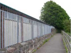
The Avon Walkway runs alongside the River Avon at the proposed bridge location. This footway/cycleway is to be realigned to make use of the proposed controlled Toucan crossing near the start of the bridge. This will also serve to remove the section of walkway that is significantly below the high water level.

The Bridge
The river alignment is unchanged by the works and the new bridge soffit will be above the 1:100 year flood level. The existing riverbanks are unstable in places and a piled solution is proposed to prevent future failure of the riverbanks. During construction it is proposed that these piles will also provide support of the bridge deck before being cut back to below the riverbank.
The choice of location of the bridge provides opportunities for an enhanced setting on the northern bank, while the final nature of the bridge’s setting on the southern bank will emerge from the future development of the Temple Quay 3 site.
The top chords of the bridge are formed from a curved truss with welded connections to give a clean, uncluttered form. The three lane carriageway is separated from the cycleway by the truss, whose members spring from the walkway. The truss uprights are protected from vehicle impact by robust barriers. Handrails to the balustrading are to be from timber from sustainable sources with the footway lit by energy efficient LEDs.
Architectural heritage
The proposed new bridge is close to the 19th century Totterdown Lock that joined the River Avon on the Floating Harbour. This historic structure will be left in place. The now redundant lock is crossed by the old arch bridge on Cattle Market Road, which, in the past, has been strengthened by being infilled. This structure will be preserved as the road is widened and the form of the bricked-in faces of the bridge will be reinstated on the new alignment.

