A2 Shore Road, Greenisland |
|
Whole Project Award with Interim
Project Team
Client: DRD Roads
Service (Eastern Division)
Design: URS Corporation
The project
The A2 Shore Road is part of the strategic road network in
Northern Ireland and provides a link between the two urban centres of
Belfast and Carrickfergus, before continuing northwards to Larne. The
2.5 km length of the A2 Shore Road at Greenisland is an existing 2-lane
carriageway on a route that otherwise has at least 4 lanes and is a
source of delays, particularly at peak times, not least to bus services.
It is regarded as a bottleneck on the strategic road network.
The A2 at Greenisland is fronted on both sides by residential properties. It is adjacent to Belfast Lough SPA though is separated from the Lough by detached residential properties. Adjacent housing, housing estates, the University of Ulster Campus and Belfast High School lie to the landward side, though there are some areas of agricultural land beyond the immediate housing that are regarded as ‘green wedges’ in the Belfast Metropolitan Area Plan (BMAP) 2015.
After the Public Inquiry into the scheme, held in October 2007, the preferred route was progressed. The chosen route will see 1.6 km of existing road widened; known as the ‘online section’. The remaining section of the scheme will diverge from the existing road through agricultural land over approximately 1.3 km and then tie back online to the existing road; this is known as the ‘offline section’.

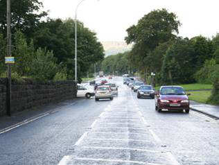
Dual Carriageway into Single Lane Carriageway
‘bottleneck’ at the beginning of the scheme
Public Consultation
Various public consultation events were held during the project planning
stage to ensure the public were made fully aware of the scheme and allowed
input into the scheme development. A number of public exhibitions were
held, followed by further meetings with locally-based organisations
(including local schools and churches). There was an opportunity for
the public to provide feedback to the design team by returning questionnaires
distributed during the exhibitions and this fed into the overall design
process. There were also individual meetings with all those likely to
be directly affected by the scheme, such as local residents, to discuss
the proposals and seek their input.

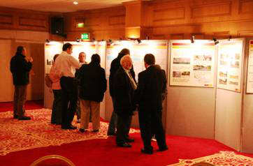
Public Exhibition, February 2007
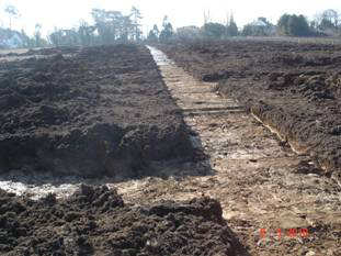
Advance Archaeological Investigation
In order to evaluate and retain potential archaeological artefacts
and information prior to the main construction of the scheme, the Client
commissioned an Advance Archaeological Investigation. The investigation
methodology used for the offline agricultural section was an innovative
solution. Initially a geophysical survey was used to determine the areas
most likely to contain artefacts; these areas were then subject to a
full topsoil strip as part of the investigation. All other areas were
investigated using herringbone trenching to reduce cost to the Client,
reduce sediment runoff, pollution potential and reduce the risk of contractual
delays. No significant archaeological finds were made. During the main
construction contract, an archaeological watching brief will be employed
to ensure any remaining potential archaeological finds are recovered.
This methodology is being used as a pilot case by the Department for
Regional Development Roads Service (DRD RS) and the Northern Ireland
Environment Agency (NIEA) to determine if sample surveying/test trenching
gives a good estimation of probable archaeological finds across the
whole site.
It was acknowledged that for the majority of the online section of the
scheme, previous road construction activities and other disturbance
would make it unlikely that archaeological artefacts remained. However,
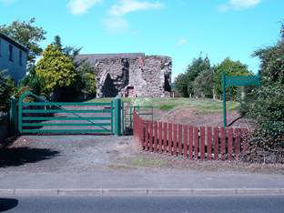
adjacent to the existing road is Castle Lug, a 16th Century Scheduled
Monument. After investigation of the grounds likely to be disturbed
by the main road construction showed no archaeological remains, the
scheme will now incorporate the monument by improving public access.
|
|
Design Features
A number of environmentally beneficial design features have
been incorporated into the design, as set out below:
- Culverts have all been designed to accommodate 20% more flow than a 1 in a 100 year flood to account for the potential increases in flow due to climate change.
- The design will allow for an attenuation pond, which will accept road drainage discharge from the majority of the 1.3 km offline section.
- The landscape design addresses the character of the area through careful choice of retaining wall cladding materials which will be continued throughout the full length of the scheme providing continuity.
- Mature trees have been retained where possible and road levels have been designed to remain close to existing levels.
- Enhanced habitat for wildlife through additional hedgerow planting
in the offline section.
A combined cycleway/footway has been incorporated along the full length of the online section. - Use of low noise surfacing along its entire length and a small number of properties will benefit from acoustic glazing where predicted noise levels may increase marginally as a result of the new road construction.
- Improved entrance with enhanced parking and set-down facilities for a local high school.
- Incorporation of bat boxes to enhance bat habitat and one of the watercourse culverts will include provision for an otter pass.


